
About the Yukon Geographical Place Names Board
The Yukon Geographical Place Names Board (YGPNB) meets at least twice a year to decide upon proposed names. The Board has six members appointed by the Minister of Tourism and Culture, three of whom are nominated by the Council of Yukon First Nations (CYFN). The Board solicits advice and information from local experts and such organizations as the Yukon Archives, the Yukon Native Language Centre (YNLC), CYFN and the Yukon Historical and Museums Association (YHMA). All of the Board members have special interests and backgrounds relevant to geographical names review. The Board operates in cooperation with the territorial government’s Heritage Resources Unit and has a close association with the Yukon Heritage Resources Board (YHRB).
The YGPNB reviews geographical name submissions and makes recommendations to the Minister on whether an application should be approved or not. The recommendations are based on careful research and consultation with the people who live in the area where a name is being considered. Once the Minister has given approval to new names, they are then forwarded to the Geographical Names Board of Canada Secretariat, where they are entered into the national Toponymic Database. Official names in the database are used in the production of gazetteers and topographical maps.
In the case of Yukon First Nations, they may name or rename geographical features on their Settlement Lands. These names are then deemed to have been approved by the YGPNB and are forwarded to the Minister for consideration.
The Formation of the Yukon Geographical Place Names Board
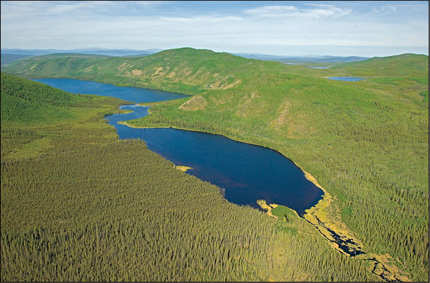
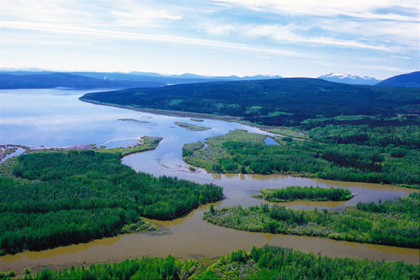
Geographical Place Names are an essential part of Yukon’s heritage. They preserve a record of the territory’s rich history and culture, giving the landscape power and meaning.
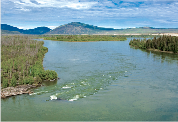
Names such as Gyò Cho Chú (Big Salmon River) tell where animals and fish are plentiful.
Other names, such as Tthechä̀l Mǟn (Sekulman Lake) “stone scraper for hides” describe artifacts, people and events. Today’s Yukon First Nations still remember these names and are working to record them for future generations.
Beginning in the nineteenth century, explorers, fur traders, and prospectors came to the Yukon to trade with native people, search for gold, and explore the vast landscape, giving their own names to the land. The Danish explorer Vitus Bering was the first non-native to name a geographical feature in northwest America.
Bering had entered the newly formed navy of the Russian tsar Peter the Great and in 1724 was appointed to conduct an expedition to explore the water routes between Siberia and North America. In 1741, Bering named an island lying off the coast in the proximity of a very prominent mountain. He anchored near the island on St. Elias’ feast day and named the island for the saint.
The dominant mountain in question was, later in the eighteenth century, given the name of the island and Mount St. Elias become one of several peaks that define the border between Canada’s Yukon and the American State of Alaska.
While Bering and explorers to follow gave names to geographical features without asking the local names for places, others, such as geologist George Dawson and the Yukon’s first Commissioner, William Ogilvie, recorded many native names during their years in the Yukon, including the Yusezyu and Tatchun Rivers in central Yukon.
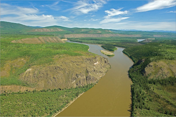
Many of the official names on the Yukon map today were given by non-native settlers who came to the Yukon during the Gold Rush period of the 1890s. In the area around Dawson City, Allgold, Bonanza, Eureka, and Nogold recall the successes – and failures – of the miners who came to the territory during the Klondike Gold Rush. Names such as Carcross (from Caribou Crossing), Fox Lake, and Eagle’s Nest Bluff, testify to the richness of Yukon’s wildlife resources.
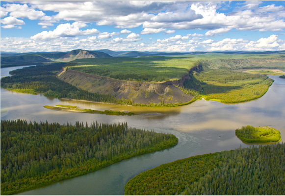
Other places, such as Five Finger Rapids on the Yukon River, Blackstone Mountain, and White River, were named for the shape, colour, and form of the land and water itself. One of the best known names of this type is Whitehorse, which took its name from the White Horse Rapids, whose foamy white crests reminded early prospectors of horses’ manes. Another legend tells of a chief’s white horse drowning there.
How does a name become official? During the 1880s and 1890s, American explorers such as Frederick Schwatka had established a pattern of naming Canadian geographical features after Americans and Europeans. An example is Miles Canyon located near Whitehorse that was named after General Nelson Miles. There was concern in Ottawa over Americans naming geographical features without consulting the Canadian government, and so in 1897, Canada established the Geographic Board of Canada, whose mandate was to approve official place names across the country.
Interestingly, one of the motivations for establishing this board came from events happening in the Yukon, from the discovery of gold in the Klondike. Today the successor to the national Board is known as the Geographical Names Board of Canada (GNBC).
The GNBC is made up of 23 members representing the provinces and territories as well as federal departments that deal with surveying, mapping, translation, archives, parks, and native affairs. The Manager of the Heritage Resources Unit of the Yukon Government’s Department of Tourism and Culture – Cultural Services Branch sits as the Yukon representative on this board.
For many years, the Department of Indian and Northern Affairs (DIAND) made recommendations to GNBC on geographical naming in the Yukon. DIAND would often seek local input when making these recommendations, but the authority still lay in Ottawa. This meant that the Yukon, unlike the provinces, did not have responsibility for geographical naming.
In 1986, the responsibility for naming geographical features was transferred from DIAND to the Government of Yukon, putting geographical naming in the hands of Yukon residents for the first time. As part of this transfer the Government of Yukon established the Yukon Geographical Names Board (YGNB) in 1987 to undertake the job of researching and approving geographical names.
In 1995, under the Yukon Land Claims Agreement, the Yukon Geographical Names Board was replaced by the Yukon Geographical Place Names Board (YGPNB). Like its predecessor, it was established with the primary function and responsibility to consider and recommend the naming or renaming of places or features located within the Yukon.
Guiding Principles
The YGPNB bases its decisions on whether to recommend or rescind a particular place name to the Minister of Tourism and Culture on a number of principles and procedures first established by the Geographic Names Board of Canada
- First priority shall be given to names with long-standing local usage by the general public, particularly indigenous names in the local native language.
- The Board has no jurisdiction over the names of municipalities, transportation corridors (highways and bridges), parks, territorial division, and other legal bodies that have been created by, or result from, legislation.
- Names for rivers, lakes, creeks, and other physical features should be used for all parts of the feature. In other words, you would not call the Yukon River one name at Whitehorse and another name at Dawson.
- Proposals to name a place or geographical feature after a specific person should show how the person to be commemorated has contributed significantly to the area where the feature is located. In most cases, personal names are given to geographical features only after a person’s death.
- When proposing names for unnamed features—those for which no local names exist—preference will be given to names from native languages, names that describe the feature, names associated with historical events, and names of people who have made an important contribution to the area where the name is proposed.
- Geographical names should be recognizable words or acceptable combinations of words, and should be in good taste. Names that are discriminatory or derogatory from the point of view of race, sex, colour, creed, or political affiliation are not accepted.
- The spelling and accenting of names should agree with the rules of the language in which they are written.
The Board is bound by a federal, provincial/territorial agreement which provides that applications to name or re-name geographical features in national parks will not be made unilaterally. This agreement also specifies that when geographical features are wholly or partly located within a national park, names and name change proposals are to be referred through the Geographical Names Board of Canada who will consult with the appropriate federal, provincial or territorial organization or agency responsible for place names in that jurisdiction.
Principles and Procedures for Geographical Naming 2011- Geographical Names Board of Canada
Annual Reports
Click on the links below to download a PDF copy of the annual report for that year.
Board Members
John Ritter, Co-Chair
Mr. Ritter has served the Board for four consecutive terms. He is also founding Director of the Yukon Native Language Centre. As a linguist, he has worked with all Yukon languages and contributes to the spelling and pronunciation of native place names. Also crucial to the place name application process is his ability to provide the Board with translation services during consultation periods held with native elders.
John Ritter
Co-Chair
Testloa Smith, Co-Chair
Testloa Smith was appointed to the Board in 2016. He is a member of the Ross River Dena Council and is a fluent speaker of the Kaska language. Testloa has served in various capacities for the Ross River Dena Council and the Kaska Dena Council for many years. He is currently serving as Land Steward in the Department of Lands, Resources, and Heritage for the Ta’an Kwäch’än Council in Whitehorse.
Testloa Smith
Co-Chair
Anne Leckie
Anne Leckie holds a Ph.D. in Geography from the University of Calgary and has worked in Yukon Land Claims and Implementation since the 1980s. She has engaged with First Nations in lands and heritage resource management including built and intangible heritage projects. For over a decade Anne served as Director of Lands and Resources and later as Executive Director to the First Nation of Na Cho Nyak Dun. She continues to provide consulting services to Yukon First Nations in the area of implementation.
Anne has a passion for Yukon history and was a founding member of the Mayo Historical Society. She is a published academic author and her work also includes chapters in the local Yukon history books Gold and Galena and Heart of the Yukon. Anne has served on a number of Yukon boards including the Silver Trail Chamber of Commerce, the Yukon Chamber of Commerce, the Yukon Water Board, The Yukon Heritage Resources Board and, most recently, Anne served as Chair of the National Trust for Canada. Anne has lived for over 35 years off-grid at her farm between Stewart Crossing and Mayo Yukon.
Anne Leckie
Member
Zena McLean, Member
Ms. McLean is a member of Carcross-Tagish First Nation with Tlingit and Scottish/German ancestry. Her Chilkat Tlingit family roots reach past the discovery of gold in Yukon. Zena was born in Northern BC, and raised in Carcross and Whitehorse, Yukon. Retired from a career with Transport Canada she now works for the Parks Canada Field Unit on the Chilkoot Trail – the trail of her ancestors. Ms. McLean was appointed to the Yukon Geographic Place Names Board in 2019 and is also a member of the Yukon Heritage Resources Board and the Carcross Tagish Renewable Resources Board. Zena is passionate about ensuring that Yukon First Nations heritage and culture is preserved within the Yukon territory.
Zena McLean
Member
Gerry Perrier, Member
Mr. Perrier has worked in the mapping sector for over 30 years and is currently the Geomatics Administrator for the Yukon Department of Environment. He leads the department’s geomatics unit in the development and delivery of mapping and GIS solutions in support of Fish & Wildlife, Yukon Parks, Water Resources, Environmental Programs, and Conservation Officer Services.
Gerry Perrier
Member
Bessie Cooley
Ms. Cooley is a fluent speaker of the Tlingit language and served for many years as the Tlingit Language Instructor at the Teslin School. At Yukon College she completed the Certificate and Diploma Courses for Native Language Instructors, and earned both an Associate of Applied Science degree in Native Language Education and a Bachelor of Arts degree in Native Studies at the University of Alaska Fairbanks. In retirement Bessie continues to serve as a Tlingit language resource person and mentor in her home community of Teslin.
Bessie Cooley
Member
Matthias Lemke, YGPNB Secretariat
Mr. Lemke has lived in Yukon for over 40 years. He began providing financial and administrative support to the Board in the fall of 2018, continuing work with Beyond Words Business Services. Matthias has a Yukon College diploma in finance and business administration and 20 years of related experience in the private sector.
Matthias Lemke
YGPNB Secretariat
Garry Njootli, Yukon Toponymist
Mr. Njootli was appointed Yukon Toponymist in 2003. He is responsible for reviewing place-name submissions sent to the Government of Yukon’s Heritage Resources Unit. He ensures they are complete and meet basic criteria before being forwarded to the Yukon Geographical Place Names Board for consideration. He also serves as a non-voting member of the Board. Mr. Njootli is a member of the Vuntut Gwitchin First Nation (Old Crow, Yukon).
Garry Njootli
Yukon Toponymist
Gazetteer
The Gazetteer of Yukon is the comprehensive record of official geographical names in Yukon.
The first, provisional, edition of the Gazetteer of Canada was issued in 1958. This official record of geographical names in the North was released as a joint Northwest Territories and Yukon Gazetteer. In 1971, a second provisional edition was produced with separate gazetteers for each territory. The first comprehensive record of official geographical names was published in 1980. The fourth and final publication of the Gazetteer of Yukon was in 1988.
In 1995, the Heritage Resources Unit, Department of Tourism and Culture issued a new edition of the Gazetteer of Yukon, the first comprehensive issue of geographical names in the Yukon for seven years. Since then, it has been updated quarterly and contains over 5,000 entries of official and alternate geographical names. The information contained in the Gazetteer of Yukon is compiled from the automated Yukon Geographical Place Names database, which is a complete list all the currently, and previously, approved First Nation and non-First Nation place names.
References
Bibliography
- Coutts, R.C. (1980) Yukon: Places Names. Sidney, British Columbia: Gray’s Publishing, Ltd.
- Dawson, George M. (1898): Report On An Exploration in the Yukon District, Northwest Territories, and Adjacent Northern Portions of British Columbia.
- Ottawa: Geographical Survey of Canada.
- Schwatka, F. (1898): Along Alaska’s Great River. Chicago: The Henry Publishing Company.
- Tom, G. (1987): Èkeyi: Gyò Cho Chú (My Country: Big Salmon River). Place Names of the Big Salmon River Region, Yukon Territory, Canada. Whitehorse: Yukon Native Language Centre.
- Yukon Native Language Centre (1997). Dákeyi: My Country. Southern Tutchone Place Names YNLC website
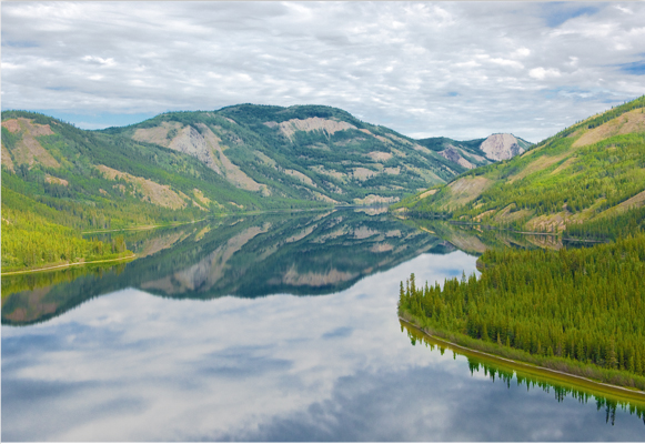
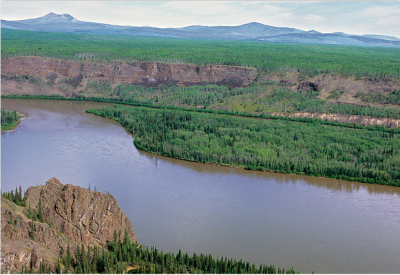
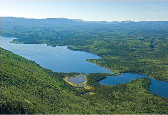
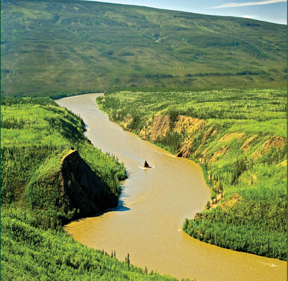
Photo Credits
All photography by Mr. Wayne Towriss for the Yukon Geographical Place Names Board and the Yukon Native Language Centre.
Get Involved
Anyone can apply to the YGPNB to propose a new name or name change for a geographical place. The application should include the name you are proposing or wish changed, location by longitude and latitude, the origin and meaning of the name, and your reasons for proposing it. The Board will carefully consider your application and conduct further research where necessary before making a decision. Such research may include talking to people who live in the area or undertaking historical research.
Oral history projects are particularly valuable for finding out about the names of places where people used to live in the past. For example, a recent oral history project collected information from Gwich’in elders who used to live along the Dempster Highway corridor years before the highway existed. An archaeologist and Yukon Heritage Resource Unit staff member recorded the Gwich’in language names of many places as well as the stories about the years these elders spent traveling from place to place in the vast wilderness of the Blackstone and Peel River country.
The Yukon Native Language Centre (YNLC) has also conducted valuable research on native place names. Northern Tutchone specialist Gertie Tom has written a book on the Big Salmon area, and YNLC staff have also worked with respected elders to record the names of places where people lived in the past. All of these research methods help to preserve Yukon place names for future generations.
Visit the YNLC web site at www.ynlc.ca
The application form may also be obtained by phone, fax, or written request to the addresses listed in the Contacts section.
Contacts
For information about the Yukon Geographical Place Names program, and for copies of the YGPNB application form, please contact:
Yukon Geographical Place Names Board
P.O. Box 31164, Whitehorse,
Yukon Canada, Y1A 5P7
Tel. (867) 667-2200
Heritage Resources Unit
Department of Tourism and Culture
Government of Yukon
P.O. Box 2703, Whitehorse, Yukon
Canada, Y1A 2C6
Tel. (867) 667-5386
Yukon Toponymist (L-1)
Department of Tourism and Culture
Cultural Services Branch
Government of Yukon
P.O. Box 2703, Whitehorse, Yukon
Canada, Y1A 2C6
Tel. (867) 667-3099
Fax. (867) 393-6456